The International Regulations for Preventing Collisions at Sea supposedly give clear indication of which ship should give-way and which is to stand-on. In reality, the situation might be different. Every year there are a number of collisions where intentions has been misunderstood. By sharing the voyage plan already stored in each ships navigation system other ships and control centres ashore can be made aware of potential risks, and measures can be taken in good time.
This feature achieves cognitive off-loading by removing the need to second-guess other ships intentions.

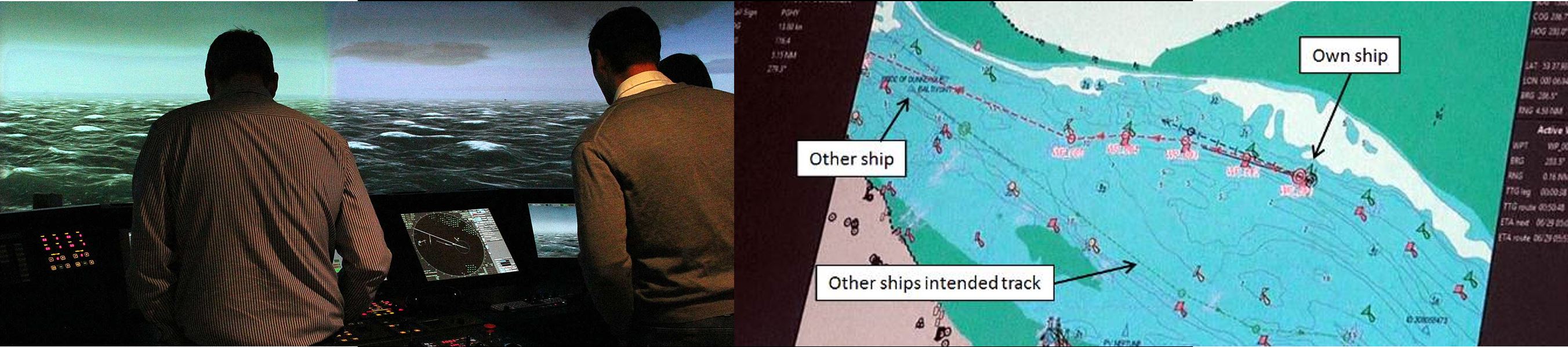
A beautiful day 2003 the Chinese vessel Fu Shan Hai collided with the Polish ship Gdynia in the southern Baltic Sea. Fu Shan Hai, coming from starboard, was the stand-on ship. Nevertheless, Gdynia applied her evasive manoeuvre too late and ran into the bow of the Chinese vessel, which subsequently sunk. If the respective voyage plans of both ships had been coordinated it would have been easy to detect that the two ships were to be at the same place at the same time.
.
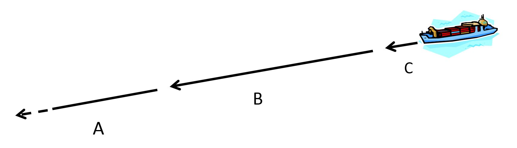
Taxonomy of route exchange. A ships future voyage can be divided into three distinct sections. (A) Strategic route exchange. A ships entire voyage plan from berth-to-berth. The strategic plan in not public and can be coordinated long in advance. (B) Tactic route exchange. Each ship transmits a number of waypoints ahead (e.g. 30-90 minutes) to other ships within radio range.(C) Predictor values, 3-9 minutes ahead. Well defined by the inertial properties of the ship's motion.
.

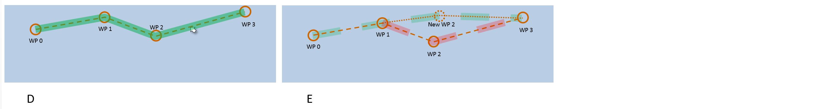
The onboard HMI of Strategic Route Exchange. (A) The waypoints of the voyage plan is clicked out as normal. Then "Send to Ship Traffic Coordination Centre" is selected from the context menu. (B) While the route is pending, waiting for an OK from the coordination system, a yellow, hashed underlay is shown. (C) The route has returned from the coordination centre with a green, hashed background signifying that it has been approved or "recommended". The ship's master now needs to "Accept" or "Reject" it. (D) If accepted the route turns green as a sign of a coordinated and agreed route. (E) The coordination system might also suggest (and motivate) an alternative route. Then a negotiation will take place.
.
Text
Publications
Porathe, T. (2006). 3-D Nautical Charts and Safe Navigation (dissertation). Malardalen Univarsity Press, Västerås, Sweden
Porathe, Thomas. (2015) Human Error and e-Navigation: Developing the Nautical Chart as Resilient Decision Support. In S. Yamamoto (Ed.) Human Interface and the Management of Information: Information and Knowledge in Context (Part II). Lecture Notes in Computer Science 9173. Springer.
Porathe, Thomas; Brödje, Anders; Weber, Reto; Camre, David; Borup, Ole. (2015) Supporting Situation Awareness on the bridge: testing route exchange in a practical e-Navigation study. In A. Weintrit, & T. Neumann (Eds.) Information, Communication and Environment: Marine Navigation and Safety of Sea Transportation. London: CRC Press, pp. 85-92
Porathe, Thomas; Brödje, Anders. (2015) Human Factor Aspects in Sea Traffic Management. In the Proceedings of the 14th International Conference on Computer Applications and Information Technology in the Maritime Industries (COMPIT ‘15), 11-13 May 2015 in Ulrichshusen, Germany. V. Bertram (Ed.) Hamburg, Technische Universität Hamburg- Harburg, 2015,
Porathe, Thomas; Brödje, Anders. (2015) Human Factor Aspects in Sea Traffic Management. In the Proceedings of the 14th International Conference on Computer Applications and Information Technology in the Maritime Industries (COMPIT ‘15), 11-13 May 2015 in Ulrichshusen, Germany. V. Bertram (Ed.) Hamburg, Technische Universität Hamburg- Harburg, 2015,
Footer
Copyright © 2015 · All Rights Reserved · My Website