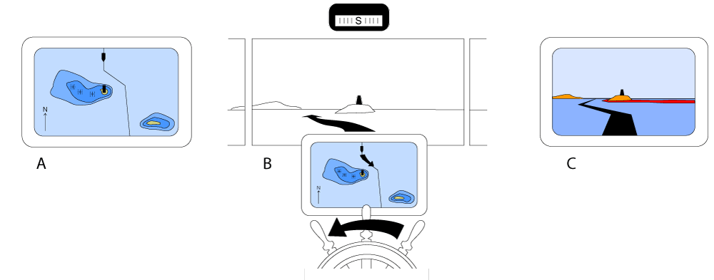
(A) Charts and radar displays are normally used in a north-up mode. (B) On this southbound vessel, a desired action to go on the east side of the central island with the cairn (a direction to the right on the chart display) leads to a turn on the wheel in the other direction (port/left). This can be confusing. (C) A conning display with a 3-D chart in a bridge perspective would simplify the decision-making in this situation.
.
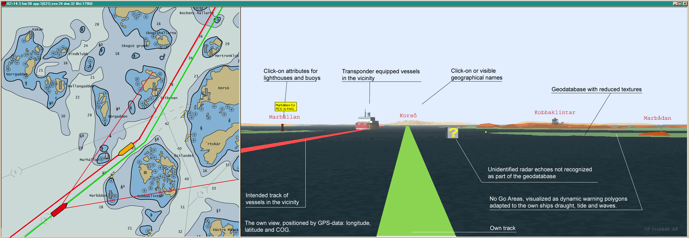
This research commenced after the Sleipner accident in Norway 1999 where a high-speed ferry lost orientation and crashed into a small island. The research question was one of finding better ways of transmitting way-showing information. The screenshot above is from a prototype application made for the doctoral thesis in 2006.
.
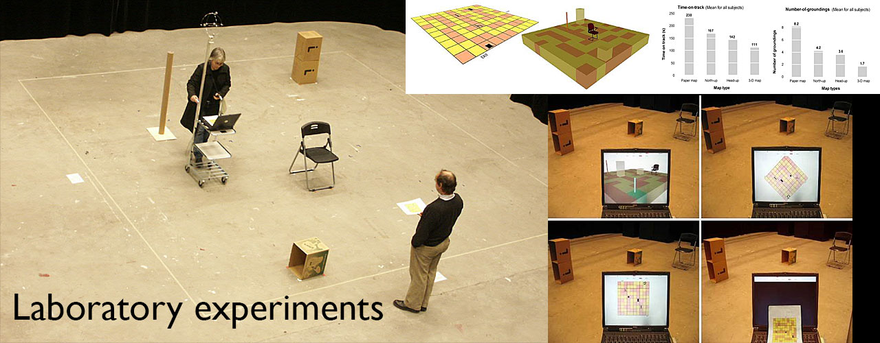
The hypothesis of cognitive off-loading was tested in a series of laboratory maze experiments in 2005, 2007 and 2011. The experimental results clearly confirmed the hypothesis
.
Publications
Porathe, T. (2006). 3-D Nautical Charts and Safe Navigation (dissertation). Malardalen Univarsity Press, Västerås, Sweden
Porathe, T. (2011). 3D Computer Graphics and Nautical Charts. In U. Freiherr von Lukas, E-M. Mahnke, K. Haase, S. Malo (eds.) Go-3D 2011 Computergraphik für die Praxis. Rostock: Fraunhofer Verlag, p. 5-15
Porathe, T. (2010) “If this will be the way to drive a ship – just anyone could do it”: 3D Nautical Charts. About creating acceptance and building standards for a VR within the maritime domain. Proceedings of the SIGRAD conference 2010 in Västerås, Sweden, 25-26 November, 2010
Porathe, T. (2008) Measuring effective map design for route guidance: an experiment comparing electronic map display principles. Information Design Journal, 16(3), 190-201. Amsterdam: John Benjamins
Porathe, T. (2008) 3-D Nautical Charts as Decision Support for Land Based Piloting. Published in the Proceedings of the 1st International Ship-Port-Interface Conference (ISPIC 2008) in Bremen, Germany 19-21 May 2008. Bremen: Buchwerft-verlag
Porathe , T. & ,Prison J. (2008) Design of Human-Map System Interaction. Published in the Proceedings of the ACM SIGCHI 26th CHI Conference in Florence, Italy 5-10 April 2008. ACM New York, NY, USA
Porathe, T. (2007) Nautiskt 3D-GIS med sikte på kognitiv avlastning och beslutsstöd. Kart og Plan,:3-2007, Vol 67, pp. 183–191. Bergen, Norway: Fagbokforlaget.
Footer
Copyright © 2015 · All Rights Reserved · My Website