The Himalayan Intake was invented by H. Stoele, SINTEF NHL. It is a geometrcial design of an intake structure to be used in run-of-the river hydropower intakes in steep Himalayan rivers. The purpose is to maintain a reservoir volume for daily peaking, by providing means of flushing out sediments from the reservoir. The intake is designed to function in a river which carry both floating debris and large amount of coarse grained sediments, including sizes up to rocks and boulders. Further description is given by (Kjellesvig and Stoele, 1996).
In 1994 H. M. Kjellesvig did her MS thesis on both physical and numerical modelling of the Himalayan intake. The following figures are based on her results. The intake is fairly complex, so several figures are needed to show how it functions.
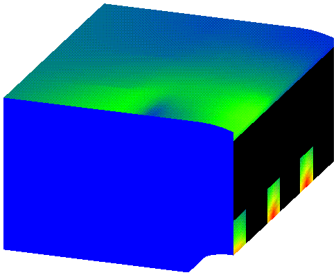
Three-dimensional view of the Himalayan Intake. The water is flowing from left to right. The colors indicate water velocity close to the walls. The blue wall closest to the viewpoint is the right side wall. The black color is a cut through the concrete dam at the downstream cross-section of the geometry. The water can flow over the dam and also through gates at the bottom of the dam.
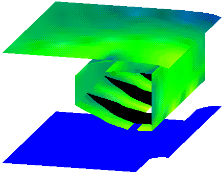
The same view, but now the end cross-section and the side wall has been removed. Behind the dam there is a tunnel with axis in the horizontal cross- streamwise direction. The walls of the tunnel are shown.
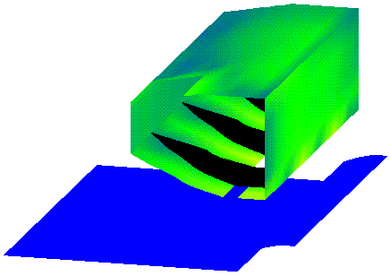
Here, the water surface has also been removed, to get a better view of the tunnel.This tunnel acts partly as a sand trap for the coarser particles. The water enter the tunnel in the side closest to the viewpoint, and exits the tunnel towards the hydopower plant at the far end.

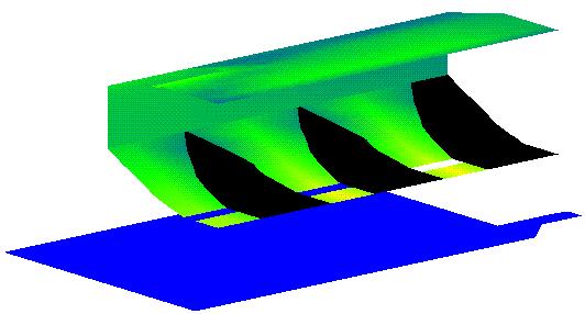
The tunnel wall closest to the dam has also been removed. The black areas indicate where the concrete support for the tunnel is located. Also note the gates in the tunnel bed. This is to exclude sediments that deposit inside the tunnel.
The same as the previous picture, but seen from another angle. The water inside the tunnel flows from left to right.
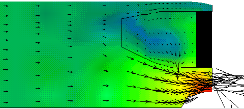
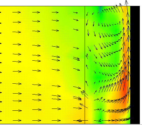
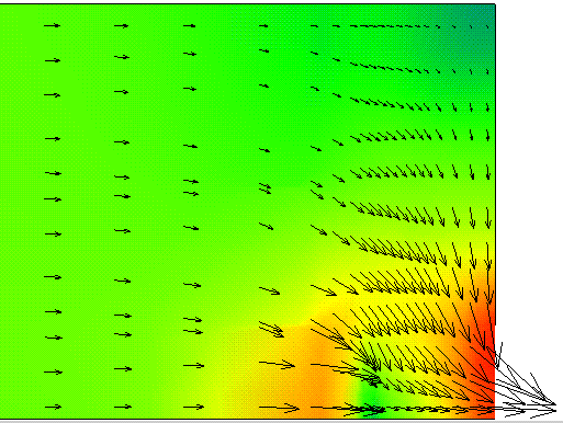
A longitudinal profile of the geometry, or cross-section of the dam/tunnel. The colors indicate value of horizontal velocity. Section close to the intake for the power plant.
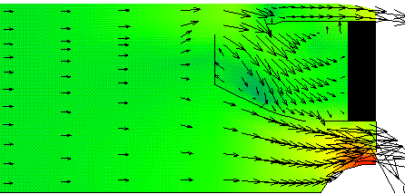
A longitudinal profile of the geometry, or cross-section of the dam/tunnel. The colors indicate value of horizontal velocity.
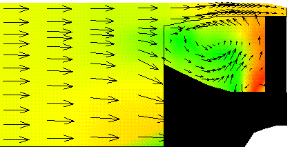
A longitudinal profile of the geometry, or cross-section of the dam/tunnel. The colors indicate value of horizontal velocity. Section close to the intake for the tunnel.
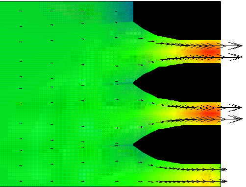
Plan view of the geometry, under the tunnel. The colors indicate velocity.
Plan view of the geometry, through the tunnel. The colors indicate velocity.
Plan view of the geometry, over the tunnel close to the water surface. The colors indicate velocity.
This page was last updated: 25 March 1997